The Smoky Mountains boast stunning views, whether you explore on foot or from the comfort of your car. So, jump into the car and enjoy a relaxing drive along some of the country’s most beautiful roadways. With majestic mountain peaks brushing the clouds, sweeping valleys, and mature hardwood forests reaching the horizon, the Great Smoky Mountain region is one of the Southeast’s most breathtaking natural wonders.
Whether you’re looking for things to do in Gatlinburg with kids or simply looking to take a break from hiking, a scenic drive in the Smokies is an absolute must. Here are some of the best scenic routes to explore in the Gatlinburg and Pigeon Forge areas.
Highlights:
By far the most popular scenic drive in the Great Smoky Mountains National Park, its fame is earned for a reason. This broad valley is one of the best places to view wildlife in the park, and this eleven-mile loop contains a plethora of historic sites and buildings. The 11-mile loop offers excellent wildlife viewing and historic sites, including three churches, a working grist mill, barns, and restored 18th and 19th-century buildings.
As you drive along this scenic loop keep your eyes peeled for wildlife walking by like famous Smoky Mountain black bears, wild turkeys, foxes, and deer. For those up for a challenge, the five-mile Abrams Falls hike leads to a stunning waterfall that makes the trek worthwhile.
Highlights:
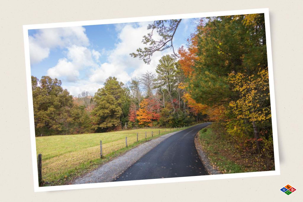
This rugged gravel road is not for the faint of heart. It winds through mile-high peaks with sharp turns on a narrow gravel road. The valley is surrounded by 6,000-foot peaks, adding grandeur to the pristine landscape. Once a prosperous settlement with a population of 1,200 people in 1910, the isolated valley is now a place where visitors can see various types of wildlife, especially elk, which were reintroduced to the park in 2001.
Visitors can explore historic sites such as a school, church, barn, and several Appalachian homesteads along the drive. Visitors can pick up a self-guided auto tour booklet on Cataloochee Valley at one of the Great Smoky Mountain National Park’s visitor centers.
Highlights:
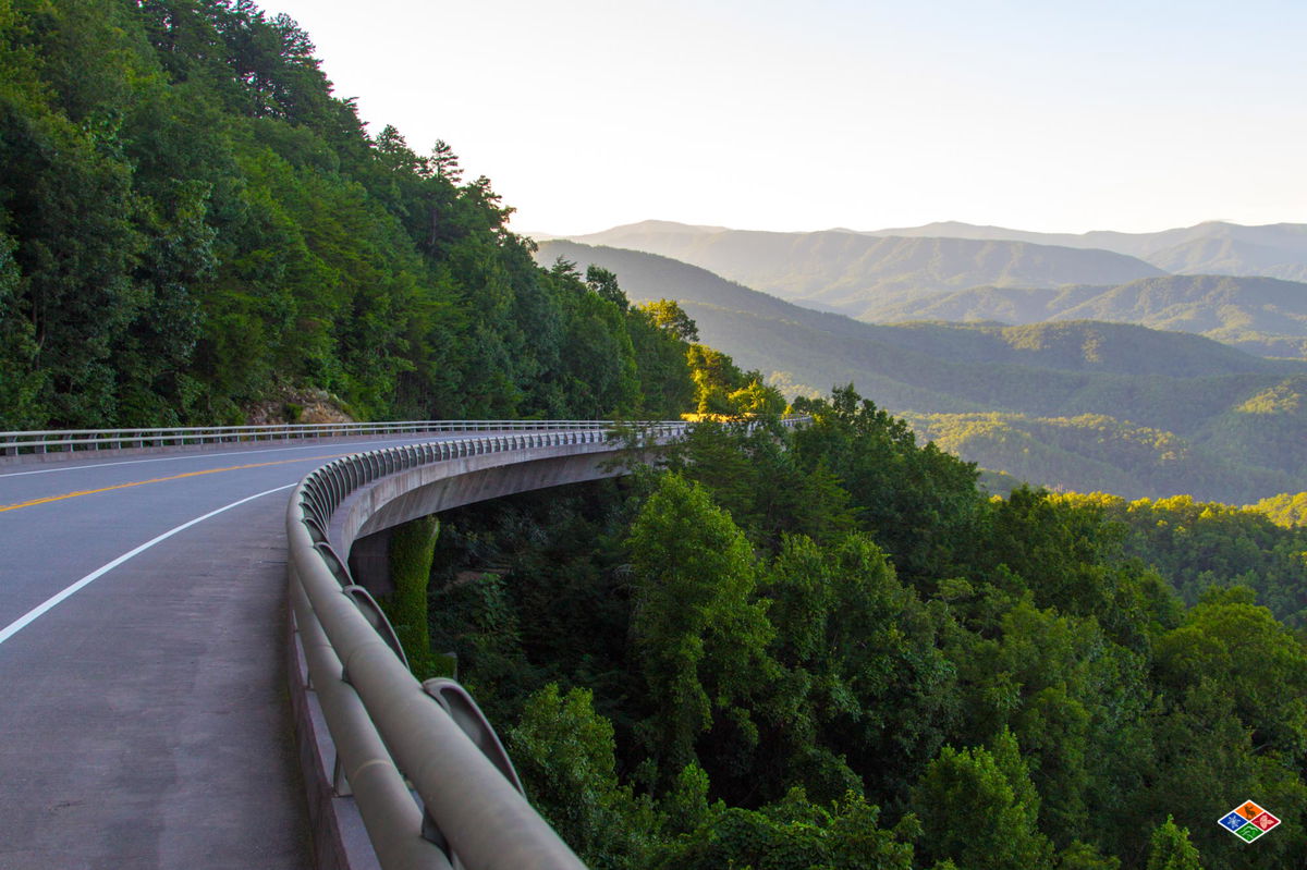
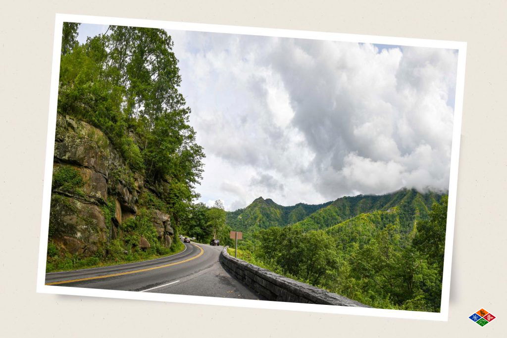
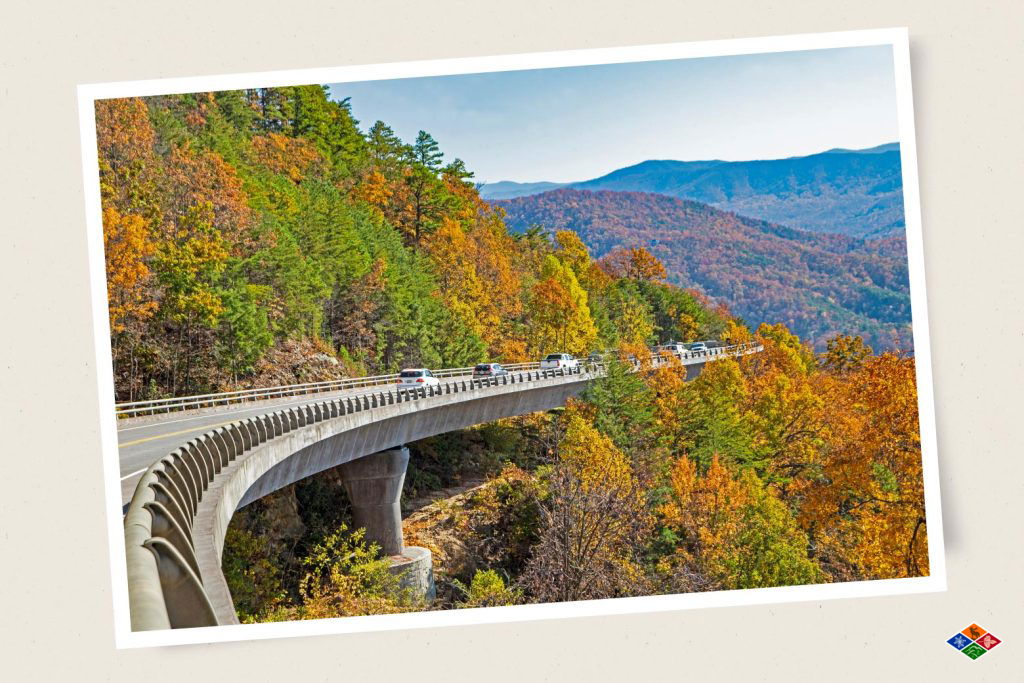
Newfound Gap Road connects Gatlinburg, Tennessee, with Cherokee, North Carolina. It passes through diverse ecosystems and reaches an elevation of 5,046 feet. Though only 33 miles long, the curvy mountain road takes about an hour to traverse, and the temperature drops noticeably at the Newfound Gap Overlook.
Highlights:
Clingmans Dome Road is a scenic seven-mile route in the Great Smoky Mountains National Park. It leads visitors to the park’s highest point, Clingmans Dome. The road winds through lush forests, offering stunning views as it ascends to an elevation of 6,643 feet.
At the end of the road, visitors can park and take a short, steep hike to the observation tower, which provides panoramic vistas of the Smokies. On clear days, views can extend over 100 miles across seven states. The road is closed to cars during the winter, from December 1-March 31, but it can be used as a hiking trail.
Highlights:
The Foothills Parkway, approved by Congress in 1944, is located in the mountainous foothills of the Tennessee Valley. This parkway runs below and parallel to the Great Smoky Mountains, offering spectacular views of the mountains from your car.
This 5.5-mile portion is located in Cocke County, Tennessee, and provides stunning views from Cosby Valley and Newport. Along this section of the parkway, visitors can stop to see famous peaks in the Great Smoky Mountains National Park, such as Greenbrier Pinnacle, Mount Guyot, and Mount Cammerer.
The Foothills Parkway West is a 17-mile stretch that travels along the backbone of Chilhowee Mountain between Chilhowee Lake and Townsend in Blount County, Tennessee. Visitors to this section can enjoy views of the Great Smoky Mountain National Park to the southeast and the expansive valley land.
Travelers looking to stretch their legs can take the fifteen-minute hike up to Look Rock from the Look Rock Overlook and take in the scenic mountainscape below.
Highlights:
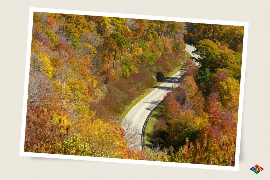
Easily accessible via the Blue Ridge Parkway, this breathtaking road gently winds up from the Blue Ridge Parkway, gaining 2500 feet in elevation as it leads back into the Great Smoky Mountain National Park. During the summer, visitors will likely see abundant wildflowers, especially magnificent azaleas. If you are visiting the Smoky Mountains in the fall, this is a great place to view the iconic Smoky Mountains fall foliage. Plenty of overlooks allow you to park your car and take photos of spectacular mountain vistas all around along the way.
Highlights:
This narrow, winding motor and nature trail follows Roaring Fork, one of the largest and fastest-flowing streams in the Great Smoky Mountains National Park. The one-way, six-mile loop takes about an hour to traverse at a slow pace, allowing visitors to take in a mix of natural beauty and historic sites, including old buildings and grist mills. The trail’s highlight is the waterfall, Place of a Thousand Drips, at stop #15, a park favorite and a must-see for photographers.
Be sure to check out the Seasonal Road Schedule for road closures and conditions before your visit.
Highlights:
You will pass through the Cherokee and Nantahala National Forests as you travel down this scenic skyway. You will have the opportunity to experience a wide range of elevations, from 900 feet above sea level to 5400 feet at Haw’s Knob on the North Carolina and Tennessee line. Near the Tellico Plains end of the skyway in the Nantahala National Forest, you will find Bald River Falls, a spectacular waterfall cascading nearly a hundred feet to the rocks below. Situated in the beautiful Bald River Gorge, these falls can be viewed from the car or accessed by a short hike. A definite must-see for your auto tour on the Cherohala Skyway!
Highlights:
The eight-mile, one-way road winds up and over Rich Mountain Gap. It’s a less crowded alternative to the popular Cades Cove Loop, providing a peaceful break from traffic and tourists. As you drive up, make sure to stop at the overlook for stunning views of Cades Cove and the historic Primitive Baptist Church, which is a favorite spot for photographers. The road is bordered by oak-dominated forests, but keep an eye out for the rare shagbark hickory trees, which are a unique sight in the Great Smoky Mountains National Park.
As you wrap up your scenic drives through the Great Smoky Mountains, remember that the adventure doesn’t have to end with the open road. For a truly unforgettable experience, consider a stay in one of Elk Springs Resort’s cabins in Gatlinburg. With its luxurious cabin rentals surrounded by nature, Elk Springs Resort offers the perfect sanctuary to relax and recharge after a day of exploring.