
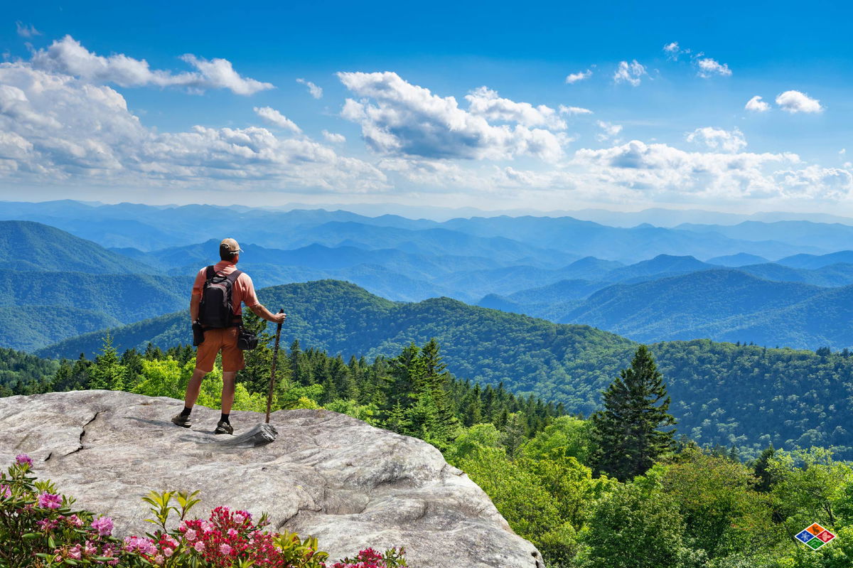
Some of the most beautiful places in the Great Smoky Mountains National Park can’t be reached by roads. With over 800 miles of hiking trails in the park, there are plenty of easy day hikes, but for those looking to explore more remote areas immersed in nature, backpacking in the Smoky Mountains is best.
Before your trek, it’s important to know the specific rules and regulations set by the National Park Service, such as getting Great Smoky Mountains backcountry permits so you can handle the park legally and safely. This guide covers permit requirements, eight top trails updated for 2026, and the planning details that determine whether a trip goes smoothly or sideways.
Before starting your backpacking adventure, following the General Backcountry Regulations of the National Park Service (NPS) in the Great Smoky Mountains National Park (GSMNP) is important. Unless you stay at LeConte Lodge, camping in the park is only allowed at designated backcountry campsites and shelters.
Backpackers must obtain a Great Smoky Mountains Backcountry permit and make GSMNP backcountry reservations to camp overnight in the park. This protects both your safety and the park’s natural landscape. Failing to follow NPS regulations can result in penalties including fines of up to $5,000 or up to six months in jail.
While the GSMNP does not charge an entrance fee, you will need a paid parking tag if you plan to park for longer than 15 minutes in any of the lots. Daily and weekly parking tags are available on recreation.gov, and if you’re planning to be a park regular, you can purchase annual passes through Smokies Life. If you buy your tag online, print it and display it in your vehicle while visiting the park. Parking tags are also available in the park at the visitor’s center.
General rules for backpacking in the Smoky Mountains:
For the most current information heading into 2026, verify details directly with the NPS before your trip, as permit procedures and fees are subject to change.
Given that the park covers over 500,000 acres of vast wilderness, choosing the best trails near Gatlinburg for your backpacking adventure can be tough. Using current recommendations and ratings from the AllTrails app, we’ve compiled a list of eight popular backpacking trails in the Smokies to get you started. From old-growth forests and rushing waterfalls to high-elevation ridgeline views, each route below offers a genuinely different experience.
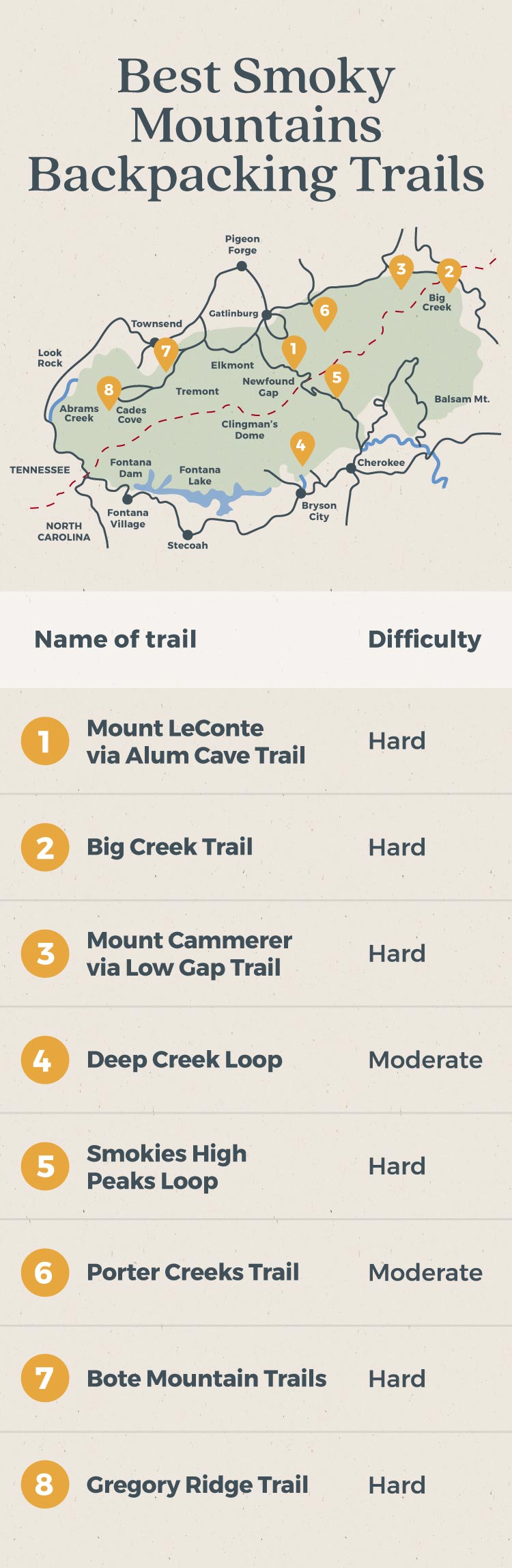
Alum Cave Trail to Mount LeConte is one of the most recognized backpacking routes in Great Smoky Mountains National Park. This scenic 11-mile out-and-back trail gains over 3,000 feet in elevation and passes several famous landmarks, including Arch Rock and Alum Cave Bluffs. It works well as a one- to two-night backpacking trip in the Smoky Mountains. Expect panoramic mountain views, rushing waterfalls, and plenty of company on the trail, particularly on summer weekends.
Pros
Cons
Big Creek Trail is a popular option for backpacking the Smoky Mountains, especially for those who want water features woven into the route. This 10.4-mile out-and-back trail is open year-round and is known for its refreshing swimming holes at Midnight Hole and Mouse Creek Falls during summer. The trail is wide, well-marked, and relatively gradual in elevation gain, which makes it accessible to backpackers at different ability levels.
Pros
Cons
If you want more of a challenge than the average Smokies trail delivers, this route delivers it. The Low Gap Trail climbs forested switchbacks through Crosby Creek Valley before joining the Appalachian Trail, then continues to Mount Cammerer, whose summit sits at 4,928 feet and overlooks the Pigeon River Gorge. Open year-round, the trail stays well maintained and connects to several side routes, which is why many backpackers use it as the backbone of a two- to four-day loop.
Pros
Cons
This nearly five-mile loop on the North Carolina side of the Smokies is known for its waterfalls, river spots, wildlife sightings, and a tubing site at the trailhead. This relatively easy trail in the Smokies is well-marked and well-maintained, making it a solid option for families or younger adventurers stepping into multi-day backpacking for the first time.
Backpackers often choose to do Deep Creek as a two- or three-day trip. Going clockwise gives you a long, slow incline; counterclockwise saves some of the best views for the final stretch.
Pros
Cons
The Smokies High Peaks Loop is the signature multi-day route in the park for backpackers who want to string together its most dramatic terrain. At 26 miles and nearly 6,900 feet of total elevation gain, this is not a casual undertaking. Most hikers who attempt it in 2026 report that four to five days gives them enough time to move at a reasonable pace and actually take in the landscape rather than just cover ground.
Backpackers can start at the Kephart Prong Trail, which links to the Appalachian Trail and continues through Newfound Gap, Chimney Tops, Alum Cave, Mount LeConte, Boulevard Trail, and finally Charles Bunion. To shorten the route, start at Newfound Gap or Alum Cave Trailhead instead of Kephart Prong. Note that campsite reservations along this corridor fill up weeks out during summer, so book as early as the 30-day window allows.
Pros
Cons
This seven-mile backpacking trail is open year-round but is most popular in the spring due to the variety of wildflowers. While the trail can get crowded during peak blooms, many day hikers turn around after Fern Branch Falls, allowing backpackers to find solace as they continue to the campsite.
Porters Creek Trail is also known for historic structures along the trail, including Elbert Cantrell farmstead, Ownby Cemetery, and John Messer’s barn. With its close proximity to Gatlinburg, hikers get the best of both worlds with nearby lodging available in creekside accommodations for after the trek.
Pros
Cons
Sorry, Cabins can’t be previewed in the block editor. You can instead save this post as a draft to preview before publishing.
.cabin-results-meta, .cabin-results-pagination { display: none; } .preview-warning { display: none; padding: 20px; background-color: #f7f7f7; color: #9d9d9d; text-align: center; } .acf-block-preview .preview-warning { display: block; } [data-results] { padding: 20px 0; } .cabin-teaser-grid { justify-content: start; overflow-x: scroll; padding: 0 20px 20px; margin-left: -20px; margin-right: -20px; grid-template-columns: repeat(4, 340px); } .dynamic-loader { margin: 0; } .cabin-teaser { box-shadow: 0 5px 20px 0 rgba(119, 119, 119, .2); } .cabins-cta { font-size: 16px; line-height: 24px; font-weight: 500; color: #fff !important; background-color: #435a43; border-radius: 24px; text-transform: none; border: none; padding: 12px 32px; letter-spacing: 0; transition: all 150ms ease; } .cabins-cta:hover { opacity: 0.7; } document.addEventListener(‘DOMContentLoaded’, () => { const wrapper = document.getElementById(‘cabins-block_cb44c5b8764def64854e852423b4cf2b’); const initialize = setInterval(() => { if (typeof Cabins === “undefined”) return; if (typeof Cabins.search !== “function”) return; clearInterval(initialize); /* begin duplicate logic from svelte */ const initialParams = new URLSearchParams(); const serverParamString = ‘types%5B0%5D=20’; serverParamString .split(‘&’) .map((part) => decodeURIComponent(part)) .forEach((part) => { if (part.includes(‘[‘)) { const name = part.substring(0, part.indexOf(‘[‘)); const value = part.substring(part.indexOf(‘=’) + 1, part.length); initialParams.append(name, value); } else { const [name, value] = part.split(‘=’); initialParams.append(name, value); } }); let bedrooms = initialParams.get(‘bedrooms’) ?? null; let occupancy = initialParams.get(‘occupancy’) ? parseInt(initialParams.get(‘occupancy’)) : 0; let types = initialParams.getAll(‘types’) ?? []; let locations = initialParams.getAll(‘locations’) ?? []; let amenities = initialParams.getAll(‘amenities’) ?? []; const filterUrlString = Object.entries({ …(bedrooms ? { elk_bedrooms: bedrooms } : {}), …(occupancy ? { elk_occupancy: occupancy } : {}), …(types?.length ? { elk_types: types.join(‘+’) } : {}), …(locations?.length ? { elk_locations: locations.join(‘+’) } : {}), …(amenities?.length ? { elk_amenities: amenities.join(‘+’) } : {}), }) .map(([k, v]) => `${k}=${v}`) .join(‘&’); /* end duplicated from svelte */ /* And use this modified format of filter string in the “see more” button */ const button = wrapper.querySelector(‘.cabins-block-footer a’); if (button && filterUrlString && !button.hasAttribute(‘data-no-filters’)) button.href += `?${filterUrlString}`; /* Perform search */ Cabins.search( `force_pg_size=4${filterUrlString ? “&”+filterUrlString : “”}`, { history: false, paginate: false, noAbort: true, wrapper } ).then((data) => { if (!data) throw new Error(“Could not retrieve weekend cabins”); if (data.raw?.cabins?.length === 0) throw new Error(“No cabins available this weekend”); // success, rendering is handled within Cabins.search function wrapper.querySelector(‘.cabins-block-footer’).style.display = “flex”; }).catch((error) => { // cabin search error or cabin search empty console.warn(error.message); wrapper.remove(); }); }, 100); })
This challenging trail near Gatlinburg is a strong option for serious backpackers who don’t want to drive far into the National Park. Bote Mountain Trail connects to four other trails before reaching the Appalachian Trail: Finley Cane Trail, West Prong Trail, Lead Cove Trail, and Anthony Creek Trail. At the top, Spence Field offers a grassy high-elevation meadow, and Rocky Top gives you sweeping views of Cades Cove and Fontana Lake. One important note for 2026: parking at the Bote Mountain Trailhead is very limited, but an overflow lot sits about 200 yards away at the Schoolhouse Gap Trailhead.
Pros
Cons
Gregory Ridge Trail is open year-round, but it’s best known for seeing Flame Azaleas, which typically reach peak bloom around mid to late June. This 11.6-mile out-and-back trail becomes quite demanding after the first few miles, making it a better fit for experienced backpackers. Wildlife sightings are common here, including black bears, deer, otters, and rattlesnakes. One logistical factor to plan around: you must drive through Cades Cove to reach the trailhead, and traffic congestion in that corridor can add significant time to your approach, especially on weekends.
Pros
Cons
First-time backpackers in the Smokies often underestimate how quickly trail conditions change at elevation. A clear morning at the trailhead can shift to fog, rain, or near-freezing temperatures on a ridgeline within a few hours, particularly in spring and fall. Packing layers is not optional.
Campsite selection matters more here than in many other parks. The GSMNP uses a designated-site system, which means you cannot simply stop and pitch wherever you choose. If your reserved site is occupied or the terrain around it is unusable due to flooding, you need a backup plan and ideally a ranger contact number saved in your phone. Check the NPS site for current campsite status in the week before you leave.
A few things experienced Smokies backpackers consistently flag for newcomers:
 Choosing the Right Size Cabin in the Smoky Mountains: A Complete Guide
 The Ultimate Guide to Wedding and Event Cabins in the Smoky Mountains (2026)
 The Best Wears Valley Secluded Cabin Rentals for a Private 2026 Getaway
 Pet Friendly Cabins in Gatlinburg: Luxury Stays for You and Your Dog
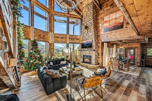 How to find a Luxury Cabin in Gatlinburg, TN
 Top 5 Things To Do In Gatlinburg, Tennessee
